Professors from the departments of Geography and History of the University of Oviedo summarize the urban history of the city through the analysis of thousands of textual, archeological and cartographic samples.
The first accurate map of the city of Oviedo was created in 1853 by Joaquín María Fernández, Tenured Professor of Mathematics of the University. This drawing showing a small province capital city, which had around 14,000 inhabitants, represents the synthesis of a thousand of years of urban history. But it is also the starting point of a large series of maps and aerial photographs that document the modern transformations of the city.
Using fragmented and heterogenous sources, a team of geographers and historians of the University of Oviedo have managed to fully reconstruct and interpret the urban evolution of Oviedo. For the first time, an evolutionary reading of the history of the city, since its foundation during the High Middle Ages to our days, is offered.
The Vrbe Project, now exhibited at LAUDEO, is part of an ambitious initiative that will also study the cities of Gijón and Avilés
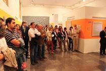
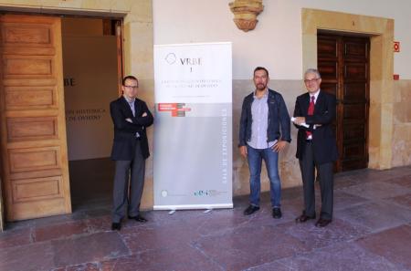
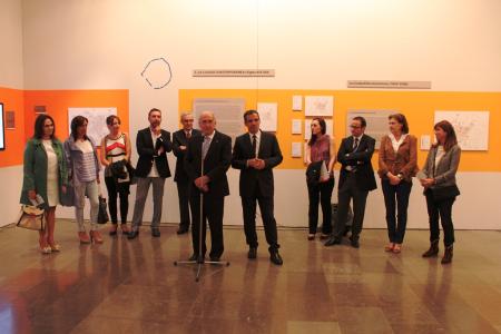
The whole research can be seen now at the exhibition titled Vrbe I. Oviedo: La construcción histórica de la ciudad, at the Cultural Center of University Extension LAUDEO. The exhibition showcases the expansion and transformation of Oviedo throughout the centuries, with maps, aerial photographs, satellite images and audiovisual material. This initiative is part of a more ambitious project that includes the reconstruction of the spatial and urban evolution of Gijón and Avilés.
The materials created for the exhibition are the result of a long trajectory of researches carried out by the Faculty of Philosophy and Letters. The hundreds of essays on the historical city written in the past decades have been condensed in this exhibition. It also includes the conclusions of current researches. The result is the creation of new original materials that, if ordered in a chronological manner, make up an unprecedented view of the history of the city.
A journey through the centuriesThe exhibition that showcases the results of the research will be featured at the exhibition hall of LAUDEO (Historical Building of the University of Oviedo) until November 8, free of charge. The exhibition is divided into three parts: the physical medium, the historical construction of the city and the modern city.
The first part of the exhibition describes the physical medium where the city of Oviedo will be emplaced, emphasizing the natural conditions that marked its development. Starting from there, a journey through the construction of the historical city starts, from the High Middle Ages to the first half of the 19th Century. Three panels gather around twenty maps that have been designed exclusively for this exhibition. The first hypothetical reconstruction of the Oviedo of the Asturian monarchy subsides to its characterization as an episcopal see. The establishment of the regional laws, at the end of the 11th Century, ushers a substantial transformation as the city transforms into an artisanal and commercial center whose protagonism belongs to its inhabitants. After the fire of 1521, the city recovers and highlights its lordly state, finally achieving an urban profile that is represented in the map of 1853.
The last section of the exhibition provides testimony of the modern city, an evolution reflected on the maps and photographs that prove its spatial growth and the alterations of the urban model used to organize it. During the period of the construction of the burgeois, or industrial, city, the marks of the model of growth are visible: ortographic projection and closed blocks at the center and working and industry neighborhoods at the periphery. The second phase, that of the industrial city, is characterized by post-war reconstruction (Gamazo Plan) and by the first general planning programs that include open blocks, zones by usage and quick communication ways (Mesones Plan). The post-industrial period starts during the decade of 1980. At first, with the coming of democracy, the inherited city is dignified and important operations of urban regeneration are started (Green Belt, Campus of El Milán and others). Afterwards, the great interior projects (Palace of Congresses, Los Prados Shopping Mall) continue and finish, but also a new generation of residential zones begins. A part of them are great zones (La Florida, Monte Cerrao, La Corredoria) that, alongside the previously mentioned ones, almost double the size of the city, which, at the same time, offloads and puts in the periphery part of its contents, blurring its nature.
El proyecto Urbe tendrá continuidad con la realización de muestras similares para los casos de Gijón y Avilés, en las que los expertos auguran una importancia destacada del mar a la hora de definir el dibujo urbano de la ciudad. La época romana tendrá un peso específico en el caso de Gijón, mientras que la historia urbana de Avilés se hace esperar hasta los tiempos medievales. En ambos casos, el papel protagonista de la industria pesada en siglo XX serán factores decisivos en su desarrollo contemporáneo.
The Vrbe Project will carry on with the creation of similar exhibitions for the cases of Gijón and Avilés, in which the experts assume that the sea will have a great importance when defining the urban layout of the cities. Roman times will be extremely important for Gijón, while the urban history of Avilés does not start until the Middle Ages. In both cases, the protagonism of the heavy industry during the 20th Century will be decisive elements for their modern development.
StewardsMiguel Calleja (Department of History)
Gaspar Fernández Cuesta (Department of Geography)
Felipe Fernández (Department of Geography)
Research TeamMaría Álvarez (Department of History)
Soledad Beltrán (Department of History)
Juan Carlos Castañón (Department of Geography)
Ramón Fernández Prieto (Department of Geography)
Marién Madera (Department of Geography)
Carmen Rodríguez (Department of Geography)
Sergio Tomé (Department of Geography)


