Researchers from the Department of Geology analize one of the latest authorized geophysical experiments on the protected reservation of El Cachucho. The first results reveal the geometry of several kilometers of depth in the Asturian basin
The Asturian coast has the deepest abyssal plains of the whole North Atlantic ocean and the first Protected Marine Area of the entire Spanish coast, El Cachucho. Researchers from the University of Oviedo have conducted detailed studies to understand better the geological and structural characteristics of the area and to establish 3D tectonic and evolution models of the Cantabrian continental platform and slope. The conclusions about the origin and the connection between the marine geological structures with those studied on land offer very valuable information, because it is one of the latest authorized geophysical experiments at El Cachucho.
Beginning in 2010, the Group of Geophysics and Structure of the Lithosphere works in the MARCAS project ("MARgen Continental ASturiano", Asturian Continental Margin), funded by the Ministry of Economics and Competitivity and led by Professor Gabriela Fernández Viejo. The 9 researchers that compose the team have been able to identify, thanks to advanced geophysical techniques, some of the deepest abyssal plains of the North Atlantic, such as the Cachucho itself, the canyon of Avilés or the canyons at the coast of Ribadesella. They have also analyzed the geological sequences buried several kilometers deep and which make up the Asturian basin.
The studies have detected a persistent and low-intensity seismic activity under the sea, associated with the trace of the fault of Ventaniella, that has been delimited more precisely
The study has been able to confirm that the slop of the Asturian coast descends from 200 to 5,000 meters of depth in a very short distance. The depths of the abyssal plains detected on the Asturian coast greatly surpass the heights that we would find in the Cantabrian Range, whose highest peaks at the Peaks of Europe reach 2,650 meters (Torrecerredo) and 2,519 (Pico Urriellu).
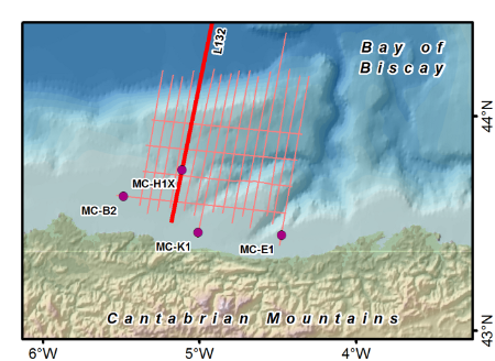
The data was obtained by employing a method known as reflection seismology, a procedure by means of which waves are sent from the surface to the marine soil and they reflect the objects found at those depths. The data obtained from reflection seismology is gathered in 2D profiles, but profile layers may be obtained to create a 3D imagen of the seafloor. The researchers have covered the Cantabrian coast with a series of around 30 layers from Santander to the Ortegal cape in Lugo, positioned from East to West and North to South.
Around 20 km into the sea, the researchers have gathered information about the seafloor thanks to the use of geophysical techniques based on the adquisition of dozens of marine seismic profiles. "Reflection seismology has allowed us to obtain a sort of ecography of the seafloor by sending waves to it that reflect whatever can be found there", details Gabriela Vázquez, lead researcher of the project.
Low-intensity seismic activity
The work of the group of Geophysical has also yielded new information of the tracing of the fault of Ventaniella, which crosses the whole regions of Asturias and Leon. The researchers have detected at the edges of that fault a persistent, though low-intensity, seismic activity that creates slight slides, according to Professor Carlos López.
Until now, the most detailed information about these seafloors belonged to oil companies, which have surveyed different points of the Cantabrian coast to develop possible energy projects.
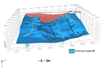
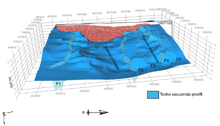
The images gathered throughout the Asturian coast are being geologically-analyzed with powerful 3D modeling programs. Obtaining a 3D model of the geometry of the seafloor of the basin during the Jurassic allows us to solve many of the main questions about the evolution of the Iberian region from the Mesozoic onwards. The fact that the Cantabrian margin has suffered extensive and comprehensive processes, and that both may be understood thanks to the structures seen in the seismic profiles, make it the perfect place to study the geodynamic evolution of the continental margins.
The results of the MARCAS project have already been presented in several congresses, such as the annual meeting of the American Geophysical Union in 2012 or the meeting of the European Geophysical Union in 2013. The conclusions on the structure and characteristics of the Cantabrian seafloor have also been published by different international specialized journals with impact.
Research Team.
- Gabriela Fernández Viejo (Lead Researcher)
- Jorge Gallastegui Suárez
- Juan Manuel Glez. Cortina
- Carlos López Fernández
- Javier Olona Allué
- David Pedreira Rodríguez
- Luis Quintana Rodríguez
- Patricia Cadenas Martínez
Cover photo: PNOA provided by © Instituto Geográfico Nacional de España.


