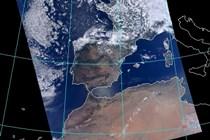
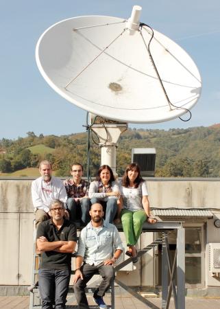
The images by the MODIS sensor received by the antenna at the Campus of Mieres allow scientist to observe in real time the origin of a fire by measuring the increase of temperature
Researchers from the University of Oviedo have established system for early remote sensing of fires thanks to the satellite images taken by the MODIS sensor, which are received daily through the antenna installed at the Campus of Mieres. The team, related to the Institute of Natural Resources and Territorial Planning (Indurot) and led by Professor Carmen Recondo, collaborates with the Emergency Service of the Principality of Asturias (SEPA) and other national entities to provide, through a web portal, all the information related to potential fires.
Satellite remote sensing has led to the early discovery of hundreds of fires and their exact point of origin thanks to the images that MODIS sends to the antenna of the Campus of Mieres and whose thermal bands show the increase in temperatures registered in these concrete points. "This information is specially valuable when the fires are started during the night or outside the common period of fires, such as in the case of Asturias", explains Recondo.
Through the web application, created in collaboration with researchers from the Department of Computer Science of the Polytechnic School of Engineering of Gijón, firefighters may also known the exact coordinate where the origin of the fire is found, making their job easier in cases of places that are hard to access.
The team of researchers from Indurot have determined the algorythms that make meteorological predictions more reliable by taking into account the temperature of the ground
The University of Oviedo is one of the three academic institutions that have a MODIS antenna in our country. The MODIS sensor travels on board the Terra and Aqua satellites and, from each of them, sends daily images of a zone that comprises the Iberian Peninsula, and part of Europe, Africa and the Atlantic Ocean. This real-time data offers optic bands, whose data is applicable, for example, to meteorology and the estudy of the state of the plant cover. On the other hand, thermal bands show changes in the temperature. The installation of the antenna was the result of the funding of a research project in 2006 by the FEDER grants and the University of Oviedo.
More precise meteorological models
The data recovered during these past few years has allowed the team led by Carmen Recondo to determine algorythms that include teh correlation between the temperature of the ground and that of the air. "Normally, meteorological prediction models do not take into account the variable of the temperature of the ground, which, when paired with that of the air, leads to a much more reliable prediction", explains the researcher. This step forward in terms of creation of more precise models has been the subject of several publications in prestigious specialized journals.
The data gathered by MODIS plays a key role in the development of terrestrial models and models to predict global changes, and it is very useful when making decisions about the protection of the environment. Its great spectral resolution extends its use to diverse applications, both related to uses of the ground, and to forest fires, floods, climate, frosting, temperature data and water vapor, etc.
- Juanjo Peón, Carmen Recondo and Javier F. Calleja. 'Improvements in the estimation of daily minimum air temperature in peninsular Spain using MODIS land surface temperature. Applications to peninsular Spain'. International Journal of Remote Sensing, 35:13, 5148- 5166, 2014. DOI: 10.1080/01431161.2014.935831
- Carmen Recondo, Juan José Peón, Eva Zapico and Enrique Pendás. 'Empirical models for estimating daily surface water vapour pressure, air temperature, and humidity using MODIS and spatiotemporal variables. Applications to peninsular Spain'. International Journal of Remote Sensing, 34: 22, 8051-8080, 2013 DOI: 10.1080/01431161.2013.828185
- Carmen Recondo, Enrique Pendás, Sofía Moreno, Covadonga Gª de Vicuña, Alfonso García- Martínez, Adán Abajo and Eva Zapico. 'A simple empirical method for estimating surface water vapour pressure using MODIS near-infrared channels: applications to northern Spain's Asturias Region'. International Journal of Remote Sensing, 34: 9-10, 3248-3273, 2013 DOI: 10.1080/01431161.2012.716912
- E. Chuvieco, I. Aguado, S. Jurdao, M. L. Pettinari, M. Yebra, J. Salas, S. Hantson, J. de la Riva, P. Ibarra, M. Rodrigues, M. Echeverría, D. Azqueta, M. V. Román, A. Bastarrika, S. Martínez, C. Recondo, E. Zapico and F. J. Martínez-Vega. 'Integrating geospatial information into fire risk assessment'. International Journal of Wildland Fire, 23: 5, 606- 619, 2014 (on line el 22-10-2012) DOI: 10.1071/WF12052
- Portal de alerta de incendios


