Experts of the Department of Geography develop a pioneering tracking system that will offer specialists and general audiences millions of snapshots taken since the 1940s
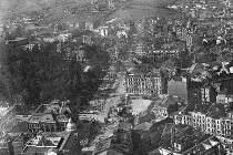
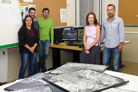
Taking picture while flying offers a privileged view of any territory, a different perspective with which to analyze its evolution through time. A group of researchers, led by Tenured Professor of Regional Geographic Analysis of the University of Oviedo, Felipe Fernández García, is developing the first system to track historical aerial photographies of Spain. This archive will offer specialists and general audiences millions of snapshots that show the changes that have taken place in our country since the 1940s until our days.
The research project, funded by the Ministry of Economics and Competitiveness, is a pioneering experience in Spain and almost all of Europe, where only on similar database has been developed in the United Kingdom and as a private initiative. The University of Oviedo coordinates members of eleven Spanish universities. The research team has performed an exhaustive work when gathering the source, which began more than a decade ago with the collection of the existing materials in Asturias, amounting to a total of almost 100,000 pictures of the Principality.
These photographies show how the territory has evolved and represent a valuable material for fields as diverse as archeology, urbanism, the environment or law
"This material represents a very valuable tool not only for researchers and teachers, but also for the administrations and professionals of such diverse fields as urbanism, landscape analysis, coast dynamics or law", explains Felipe Fernández. The sequence of the evolution traced by these images from above shows the changes that have been present in the territory, which is why this work is linked to the Cluster of Energy, the Environment and Climate Change of the Campus of International Excellence.
The main documental sources have been the Armed Forces, the collections of the Spanish Geographic Institute and some private enterprises. "Many of the public and civil works that were started in Spain during the phase of "developism" were projected and planned using the information taken from aerial photographies. Enterprises were hired to fly over the city or the place in question in order to take pictures of the zone", explains the Tenured Professor of Regional Analysis. The documental collections of some of these enterprises like Cetfa, whose originals are deposited at the Department of Geography, are part of the documental heritage gathered.
The research project will finish next year and has been developed with the goal of creating a spin-off that may answer the very high demand that exists in the market. "This material holds the key to very valuable information for different professionals", remarks Felipe Fernández.
Although the first aerial photographies were taken at the end of the 19th century, the truly significant collections, due to its size and the systematic nature of the photographies, start in the 1940s. The tracking system that is being worked on by the teams of experts will allow them to easily find all the available photographic information on a certain place (number of photographies, date, scale, archive in which they can be found, etc.) and, based on them, faitfully reconstruct the evolution they had undergone.
A simple check in an online application shows us from space any point of the territory with a desktop computer, a tablet or a cell phone. The archive of historical aerial images of Spain constitutes the immediate antecendent of these applications. In fact, some of them are beginning to incorporate to their services the ability to see pictures of the main cities of the world taken decades ago.
Research Team
- Felipe Fernández García (University of Oviedo) Lead researcher
- Carmen Rodríguez Pérez (University of Oviedo)
- Daniel Herrera Alonso (University of Oviedo)
- Cristina Fernández Bustamante (University of Oviedo)
- David Olay Varilla (University of Oviedo)
- Héctor Rato (University of Oviedo)
- Jose Maria Sierra Alvarez (University of Cantabria)
- Luis Carlos Martínez Fernández (University of Valladolid)
- Juan Sevilla Álvarez (University of Salamanca)
- Encarnación Gil Meseguer (University of Murcia)
- Guillermo Morales Matos (Carlos III University of Madrid)
- Jesús Alcalá Reygosa (Complutense University ofMadrid)
- José Balsa Barreiro (University of Santiago de Compostela)
- Carmen Ginés de la Nuez (University of La Laguna)
- Santiago Hernández Torres (University of La Laguna)
- Ignacio Maestro Cano (University of Valencia)
- Beatriz Mateos (University of Extremadura)
Banner image
Aerial view of the city of Gijón taken in 1948.


